Surface Projection of an Underground Water System
Angiogeoscopy makes it possible to precisely localize the ground surface projection of water vessels and, in particular, to determine the direction of their flow, where they start and where they end. The origin of water vessels, usually rising as a bundle, precisely positions the exurgence point of a geothermal reservoir or of an aquifer.
An underground water system is surveyed and modeled, through angiogeoscopy, from the ground surface. To grasp the main aspects of such a survey, it is useful to show how an underground water system appears to the surveyor on the ground surface.
Conceptual View
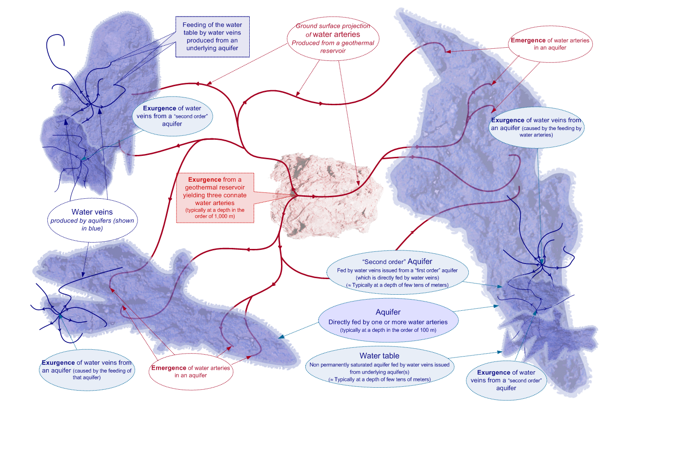
The figure below shows a theoretical view of a water system projected on the ground surface .
Projection on the ground of an underground water system.
It is important to realize that the above figure shows the projection on the ground surface of a 3 D structure (what implies, for example, that water vessels that cross each other in a plane do not intersect in space).
This is a theoretical view as our research technique can not determine the contour of water reservoirs or aquifers for reasons stemming from the very nature of our research technique (only geofluid undergoing high inter-molecular frictional forces can be detected : this happens in water vessels, not in a water reservoir of any sort).
The exurgence of a geothermal reservoir or of an aquifer is point-like and precisely localizable by angiogeoscopy. It gives rise to a star-like bundle of water vessels, which may subdivide further, typically when rising from one geological layer to another.
Water arteries end – as that happens in 99.99 % of the cases – in an aquifer (they reach the ground surface in the remaining cases). This feeding induces an overpressure that causes the formation of water veins arising from the leakage points of that aquifer. The so formed exurgence of that aquifer also has a star-like shape centered on the leakage point (up to 20 branches depending on the type of soil).
These so-created water veins end up in more shallow aquifers or in the water table. Underground water flow is propagated upward through a growing number of water vessels having a decreasing flow rate (the flow rate decreases in proportion of the increase of the number of water vessels).
Ground Survey
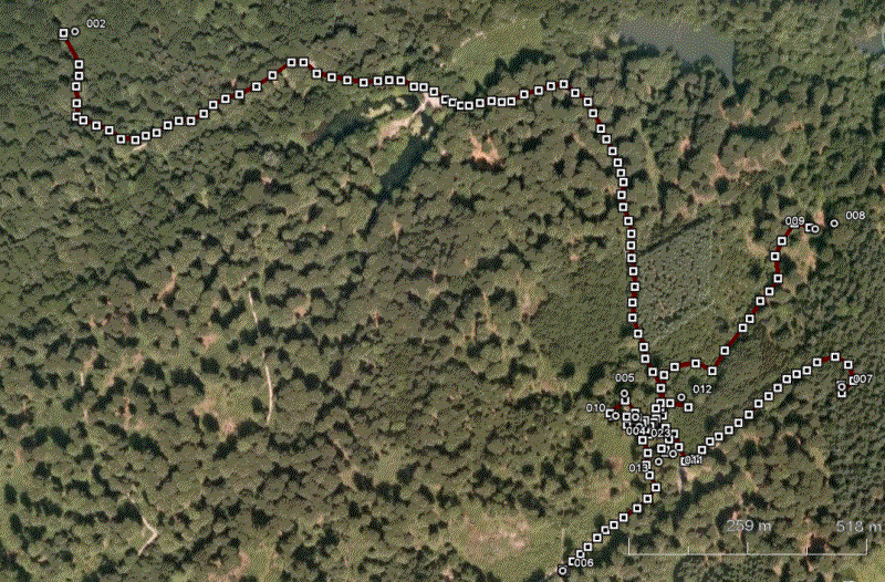
The photograph below shows a GPS survey around the exurgence of a geothermal reservoir and the concomitant formation of a bundle of water arteries. This GPS survey has been integrated to a satellite photo.
Ground Survey of the exurgence of Water Arteries
This ground survey provides a first assessment of the hydrogeological resource. The collected data is fed into our hydrodynamical model to assess the potential of the resource.
The leakage point (exurgence) shown above is subdivided in nine main branches of various lengths (secondary branches are not shown). The exurgence shown is located at approximately 1,100 meters deep. The length of the arteries is statistically correlated with their flow rate. This length also depends on the likelihood of hitting an aquifer. The ground surface projection of a water artery typically varies between a few tens of meters to several kilometers (it can, exceptionally, exceed five kilometers for the longest water arteries).
The exurgence point is localized with a centimetric precision through angiogeoscopy, i.e. with a precision higher than what can be obtained from a topographic GPS. During a hydrogeological exploration, the ground surface projection of exurgence points (which are the main focus of our research) are marked precisely on the ground. These points correspond precisely with the recommended drilling location.
The hydrodynamics of water vessels is such that their elevation profile is more regular than their ground surface projection.


